Menu

$332.00

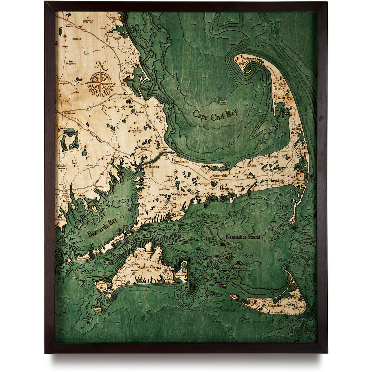
Cape Cod - Large
• 3D underwater topographic map (bathymetric chart)
• Framed in solid wood, ready to hang
• Protected by crystal clear Plexiglas
• Layered laser cut natural Baltic Birch wood
• Carved relief of nautical terrain
• Wooden chart work of art that will enhance any décor
• Locations etched & highlighted with special technique
• Color may slightly vary from images shown
This historic destination attracts tourists and locals alike, especially in the summer months with its charming maritime character and plethora of beaches. Cape Cod extends into the Atlantic Ocean from the mainland southeastern corner of Massachusetts. This geographical cape has been separated from its natural mainland by the Cape Cod Canal which is crossed by two highway bridges and a railway that carries a limited number of passengers and freight. Its territory is quite expansive with fifteen towns and several villages that make up the region.
- 6’ Hedge Fence
- Abington
- Acushnet Cedar Swamp State Reservation
- Ancoot Cove
- Ashumet Pond
- Assawompset Pond
- Atlantic Ocean
- Barnstable
- Barnstable Harbor
- Bass Ledge
- Billingsgate Island
- Billingsgate Shoal
- Bishop & Clerks
- Blue Star Memorial Hwy.
- Bourne
- Brewster
- Bridgewater
- Butler Hole
- Buttermilk Bay
- Buzzards Bay
- Cape Cod Bay
- Cape Cod Canal
- Cape Cod National Seashore
- Cape Poge Bay
- Carver
- Cataumet
- Cattybunk Harbor
- Centerville Harbor
- Channel
- Chappaquiddick Island
- Chatham
- Chatham Harbor
- Chatham Roads
- Clarks Cove
- Cleveland Ledge
- Cliff Pond
- Cotuit Bay
- Coxens Ledge
- Cross Rip Shoal
- Dartmouth
- Dennis
- Dogfish Bar
- Duxbury Bay
- East Bridgewater
- Eastham
- Edgartown
- Edgartown Harbor
- Edwards Shoal
- Eel Point
- EWB
- Fairhaven
- Falmouth
- Falmouth Airpark
- Falmouth Harbor
- Fishing Ledge
- Follins Pond
- Forestdale
- Gay Head
- GHG
- Gibbs Pond
- Gosnold Naushon Island
- Great Island
- Great Ledge
- Great Round Shoal
- Great Round Shoal Channel
- Green Harbor
- Half Moon Shoal
- Handkerchief Shoal
- Harwich
- Hawes Shoal
- Head of Harbor
- Horseshoe Shoal
- Hosher Ledge
- Hummock Pond
- Hyannis
- Hyannis Harbor Channel
- Johns Pond
- Katama Bay
- Kill Pond Bar
- Kingston Bay
- L’Hommedieu Shoal
- Lakeville
- Lamberts Cove
- Lewis Bay
- Little Pleasant Bay
- Little Round Shoal
- Lobsterville
- Long Pond
- Long Shoal
- Lucas Shoal
- Madaket Harbor
- Manomet
- Marion
- Marshfield Hills
- Martha’s Vineyard
- Mashpee
- Mashpee NWR
- Mashpee Pond
- Mattapoisett
- Mattapoisett Harbor
- Megansett Harbor
- Mendisha Pond
- Menemsha Bight
- Middle Ground
- Middleborough
- Mishaum Ledge
- Monomoy Island
- Muskeget
- Muskeget Channel
- Myles Standish State Forest
- Nantucket
- Nantucket Harbor
- Nantucket Sound
- Nashawena Island
- Nasketucket Bay
- New Bedford
- New Seabury
- No Man’s Land
- North Channel
- North River
- North Tisbury
- Norton Shoal
- Norwell
- Old Man Shoal
- Onset Bay
- Orleans
- Osterville
- Otis Air National Guard
- Pasque Island
- Pleasant Bay
- Plymouth
- Plymouth Bay
- Plymouth Harbor
- Pocasset
- Point Rip
- Polpis
- Provincetown
- PYM
- Quicks Hole
- Rochester
- Rockland
- Rodgers Shoal
- Sagamore Beach
- Sandwich
- Santuit Pond
- Scituate
- Searse Shoal
- Sesachacha Pond
- Shovelful Shoal
- Siasconset
- Sippican Harbor
- South Duxbury
- South Pond
- South Weymouth
- Southwest Shoal
- Sow & Pigs Reef
- Squash Meadow
- Squibnocket Bight
- Squibnocket Pond
- Stellwagen Bank
- Stone Horse Shoal
- Succonnesset Shoal
- Truro
- Tuckernuck
- Tuckernuck Bank
- Tuckernuck Shoal
- Upper Millpond
- Vineyard Haven
- Vineyard Sound
- Wakeby Pond
- Walkers Pond
- Waquott Bay
- Wareham
- Wasque Shoal
- Wellfleet
- Wellfleet Harbor
- Weququet Lake
- West Falmouth
- West Island
- West Tisbury
- White Horse Beach
- White Island Shores
- Wilkes Ledge
- Wompatuck State Park
- Woods Hole
- Yarmouth


