


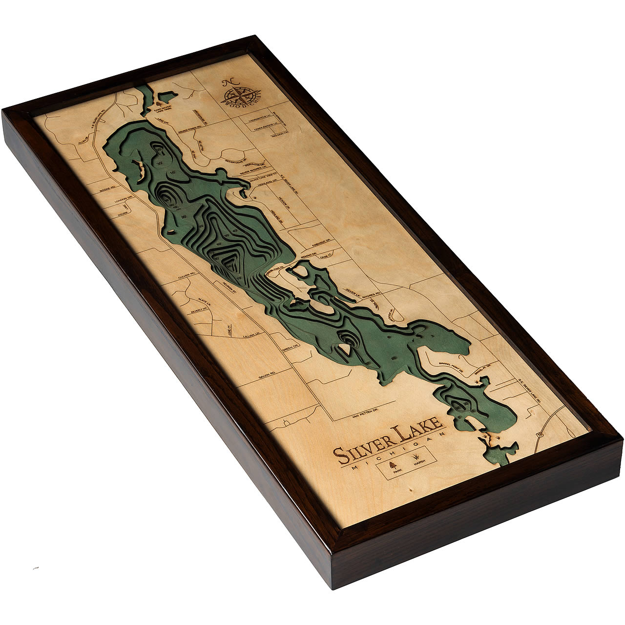
Silver Lake
Silver Lake is a lake in Grand Traverse County, Michigan. The lake is known for its irregular shoreline that is littered with beautiful pine trees and many peninsulas and islands. Despite being smaller in size, Silver Lake is an extremely popular fishing spot (even in winter for ice fishing) known for its Bass, Bluegill, Perch, Pike, Lake Sunfish, and Walleye. Throughout the year there are numerous regattas and fishing tournaments hosted at the lake. There are also public docks for boat launches and campgrounds for camping so everyone can enjoy it!
- Alice Lane
- Allen Dr.
- Beverly Dr.
- Boone Rd.
- Brakel Point Dr.
- Candlewood Lane
- Case Ct.
- Crescent Dr.
- Culver Rd.
- Dover Lane
- East Silver Lake Park
- Finehout Dr.
- Galvin Rd.
- Green Dr.
- Greenhouse Rd.
- Highland Dr.
- June Ct.
- Lake Dr.
- Lillian Lane
- London Dr.
- Meadow Dr.
- Neuman St.
- North East Silver Lake Rd.
- NW Silver Lake Rd.
- Paradise Point Trail
- Park St.
- Porsche Dr.
- Roman Dr.
- SE Silver Lake Rd.
- Silver Cove Dr.
- Silver Lake Shores Rd.
- Silver Lake View Ct.
- Silver Pines Rd.
- Silver Shores Lane
- Silverwood Dr.
- Thornapple Lane
- Valley Dr.
- Van Petten Dr.
- Waldon Cir.


